I have always been fascinated by the ridge of boulders to the north of my dad’s house in Payne Gap. I suspected that some dramatic tectonic event caused part of the hill to slide down, exposing all those large rocks, and apparently I was on the right track. I reached out to Linda Ruiz McCall, Information Geologist and Resource Center Manager at the University of Texas Bureau of Economic Geology, who shared the quoted text below. She also validated my dad’s story about riding a horse across an area near the Payne Gap Cemetery and noticing a hollow sound, which was likely because of a cave formation underneath. About 100 million years ago, the Payne Gap area was covered in shallow seas with reef formations. The bottom picture features fossilized rudists, which were the main reef/bioherm builders of this period. 1
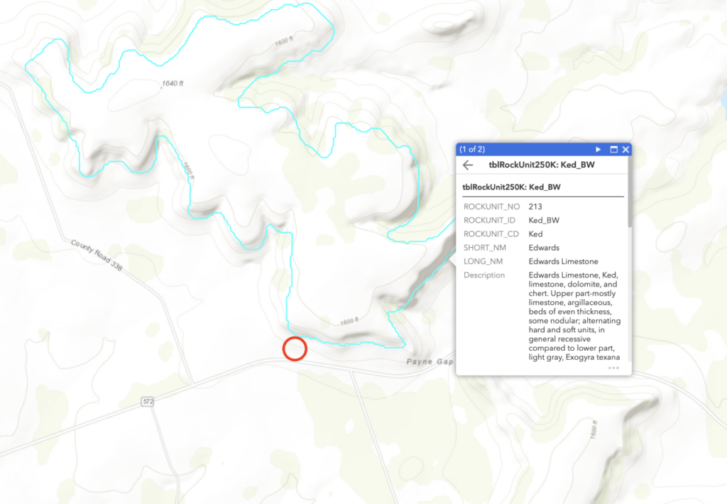
Llinda Ruiz McCall: “You have already done an excellent job of identifying the geologic units on your property. Based on your location and photographs of the rock outcrops, it does appear that the Edwards limestone is the cap of the cliff [Edwards layer can reach a total thickness of as much as 140 feet], the Comanche peak limestone lies beneath, and the less resistant Walnut formation is the flatter area at the base. Dr. Ken Wisian, Associate Director, Environmental Division, Bureau of Eonomic Geology, The University of Texas at Austin, echoes, “The tops of the hills around you are Ked (Edwards Limestone), the slopes are Kc (Comanche Peak Limestone), and the valley floor is Kwa (Walnut Formation). Detail here. These rock formations were deposited about 100 million years ago when most of Texas was covered with shallow seas … The fossils that you captured in your photo indicate a thriving community rich in bivalves and other life forms such as the Exogyra species. Over time, the marine deposits were buried beneath additional sediments and compacted into limestone.”
As Bob Loucks [Senior Research Scientist, BEG] indicated, about 60 million years ago, the rock units were uplifted and exposed to weathering and erosion which continues today as indicated by the boulders at the base of the cliff. The caves on your property were once below the surface and pathways for water much like our present day Edwards Aquifer. Given the clear karst development in the Edwards on your property, It is quite likely that hollow sound below the horses’ hooves your father was noticed is an indication of caves near the surface.”


1. Damman, Adam J. A Comparison of the Cretaceous (Albian) Edwards Limestone Bioherms of Central Texas with the Holocene Coral Reefs of Bermuda. M.S. Thesis, Baylor University, Department of Geology, 2011.